| Persons | Institutes | Publications | Projects | Datasets | Maps | ||
|
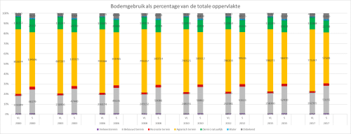
Bodemgebruik in Vlaamse Scheldegemeenten 2000 - 2017
Description De cijfers geven de absolute oppervlakte (ha) bodemgebruik weer als percentage van de totale oppervlakte in de Vlaamse Scheldegemeenten. Bron: Administratie van het kadaster, Algemene Directie Statistiek en Economische Informatie.
· Click here to return to the thumbnails overview |

